Property damage risks across U.S. regions
Floods, severe storms, wildfire, winter weather, earthquakes, and everyday plumbing or fire losses can affect homes in every part of the country. This guide compares common regional patterns, names states and example cities, and points to official tools for checking conditions closer to home.
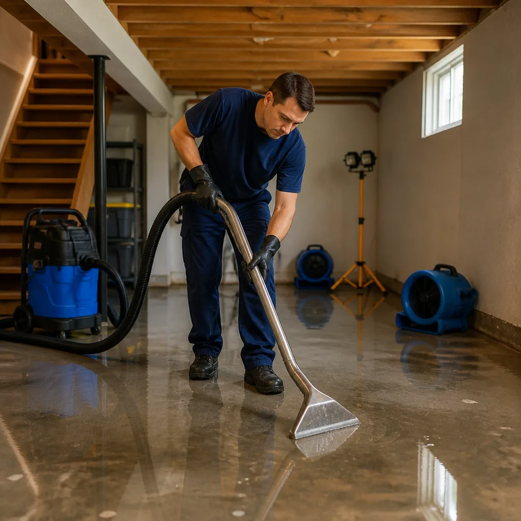
This is a broad educational guide, not a parcel-level risk assessment, forecast, hazard ranking, insurance decision, or promise of restoration-company availability. Hazards vary within every state and city with local terrain, coastlines, drainage, construction, maintenance, and the exact event. City names are examples for orientation and search—not hazard rankings or confirmed directory coverage. Use local government and official hazard tools for a specific property.
Read individually researched property-loss and restoration guides for all 50 state capitals.
Weather, disasters, and property damage by region
The regional profiles below are editorial groupings, not official climate zones or hazard rankings. State borders do not define weather or geologic exposure, and individual counties, neighborhoods, and properties can differ substantially.
Regional profile 01
New England
States and jurisdictions: Connecticut (CT), Maine (ME), Massachusetts (MA), New Hampshire (NH), Rhode Island (RI), Vermont (VT)
Example cities: Boston, MA, Worcester, MA, Providence, RI, Hartford, CT, Portland, ME, Manchester, NH, Burlington, VT
Hazards that may affect property
- Nor’easters and coastal storms
- Coastal and river flooding
- Heavy rain and urban flash flooding
- Snow, ice, and cold waves
- Severe thunderstorms and wind
New England combines a long, exposed Atlantic shoreline with rivers, steep uplands, dense older neighborhoods, and cold winters. A single storm can bring coastal surge or erosion near the shore and heavy rain, river flooding, wind, or snow farther inland.
How losses can happen
- Coastal storms can drive water into low-lying buildings, garages, roads, and mechanical areas; wind-driven rain can also reach roofs, windows, and siding.
- Heavy rain can overwhelm drainage or raise rivers, affecting basements, first floors, crawlspaces, and below-grade utilities.
- Snow, ice, and freeze-thaw cycles can load roofs, damage gutters, form ice dams, and contribute to frozen or burst plumbing in poorly protected areas.
Property-owner checks
- Check both coastal-flood and inland-river/flash-flood information for the property rather than relying on a regional label.
- Inspect roof penetrations, attic ventilation, gutters, and drainage before the cold season; know where the water shutoff is.
- After a storm, keep away from downed wires and standing water that may be electrically unsafe.
Regional profile 02
Mid-Atlantic
States and jurisdictions: Delaware (DE), Maryland (MD), New Jersey (NJ), New York (NY), Pennsylvania (PA); District of Columbia
Example cities: New York, NY, Buffalo, NY, Philadelphia, PA, Pittsburgh, PA, Newark, NJ, Baltimore, MD, Wilmington, DE, Washington, DC
Hazards that may affect property
- Tropical-storm rain and wind
- Coastal and tidal flooding
- River and urban flash flooding
- Nor’easters and winter weather
- Severe thunderstorms
The Mid-Atlantic spans Atlantic and Chesapeake shorelines, major rivers, dense cities, and inland hills. Tropical systems and nor’easters can affect broad areas, while intense local rainfall may create basement, street, and stream flooding well away from the coast.
How losses can happen
- Storm surge and high tides can affect low-lying coastal and estuary communities; wind and rain can damage roofs, windows, and exterior materials.
- Cloudbursts can exceed local drainage capacity, sending water into below-grade apartments, basements, garages, tunnels, and utility spaces.
- River flooding, winter ice, and wind-driven tree damage can affect inland properties; the dominant exposure differs between shoreline, city, and upland locations.
Property-owner checks
- Review local flood maps and drainage history, including the route water could take from streets and neighboring lots.
- Keep roof drains, gutters, sump equipment, and backwater protections maintained where present.
- Use local flood and weather alerts; a property outside a mapped high-risk area can still experience rainfall or drainage flooding.
Regional profile 03
Appalachia & the Ohio Valley
States and jurisdictions: Indiana (IN), Kentucky (KY), Ohio (OH), Tennessee (TN), West Virginia (WV)
Example cities: Indianapolis, IN, Cincinnati, OH, Columbus, OH, Louisville, KY, Nashville, TN, Knoxville, TN, Charleston, WV
Hazards that may affect property
- River and flash flooding
- Severe thunderstorms, hail, and tornadoes
- Landslides on susceptible slopes
- Winter storms and ice
- Heat, drought, and wildfire in localized areas
The Ohio Valley and Appalachian terrain combine major watersheds, steep slopes, valleys, and heavily settled urban corridors. Prolonged rain can raise rivers, while intense short-duration rain can run quickly down hillsides and into low-lying buildings.
How losses can happen
- River floods and fast runoff can reach basements, crawlspaces, roads, and ground-floor rooms; water may carry mud or debris.
- Severe thunderstorms can bring hail, damaging wind, lightning, and tornadoes that remove roofing, break windows, or allow follow-on water intrusion.
- In mapped or locally known slope areas, saturated ground can contribute to slides that damage foundations, retaining walls, driveways, or buried utilities.
Property-owner checks
- Consider both upstream watershed conditions and the slope, retaining walls, and drainage immediately around the home.
- After wind or hail, document visible roof and exterior damage from a safe location and watch for leaks.
- Do not walk or drive through floodwater, and avoid damaged slopes or structures until they are judged safe.
Regional profile 04
Southeast Atlantic
States and jurisdictions: Georgia (GA), North Carolina (NC), South Carolina (SC), Virginia (VA)
Example cities: Atlanta, GA, Savannah, GA, Charlotte, NC, Raleigh, NC, Wilmington, NC, Charleston, SC, Columbia, SC, Richmond, VA, Virginia Beach, VA
Hazards that may affect property
- Hurricanes and tropical-storm remnants
- Coastal surge and heavy rain
- River and flash flooding
- Tornadoes, hail, and straight-line wind
- Heat and persistent humidity
The Southeast Atlantic region ranges from barrier islands and coastal plains to inland foothills. Tropical systems can produce several kinds of damage in one event—surge near the coast, freshwater flooding inland, and wind or tornado damage along the storm track.
How losses can happen
- Wind and wind-driven rain can damage roofing, soffits, windows, and siding; water may then enter attics, wall cavities, and finished rooms.
- Heavy rain can flood streets, basements, crawlspaces, and river-adjacent properties, including locations outside coastal surge zones.
- Warm, humid conditions can slow drying after a leak or flood; hidden damp building materials can remain a concern if moisture is not addressed.
Property-owner checks
- Distinguish storm-surge exposure from rainfall, creek, and river flooding; these are different pathways and maps.
- Keep vegetation and roof drainage maintained, and know how to shut off utilities if local officials advise it.
- After water intrusion, prioritize safety and drying; avoid disturbing suspected contaminated or structurally unsafe materials.
Regional profile 05
Florida Peninsula & Panhandle
States and jurisdictions: Florida (FL)
Example cities: Jacksonville, FL, Orlando, FL, Tampa, FL, St. Petersburg, FL, Miami, FL, Fort Lauderdale, FL, West Palm Beach, FL, Tallahassee, FL
Hazards that may affect property
- Hurricanes and tropical storms
- Storm surge and coastal flooding
- Extreme rainfall and flash flooding
- Strong wind, tornadoes, and lightning
- Heat, humidity, and localized wildfire
Florida has both Atlantic and Gulf coastlines, low-lying communities, inland lakes and rivers, and strong differences between the Panhandle, peninsula, and Keys. Coastal proximity alone does not describe a property's full exposure: rainfall, drainage, elevation, wind, and surge are separate considerations.
How losses can happen
- Storm surge, waves, and tidal flooding can affect coastal or connected low-lying areas; heavy rain can create inland flooding far from the immediate shoreline.
- Strong winds and flying debris can damage roofs, screens, garage doors, windows, trees, and power service, allowing secondary water intrusion.
- High heat and humidity can worsen the effects of leaks and building-envelope failures; lightning and severe storms can also cause direct fire or electrical damage.
Property-owner checks
- Check the local evacuation zone, flood map, drainage conditions, and wind exposure separately; none substitutes for another.
- Keep roof, opening protection, trees, and drainage maintained before storm season and follow local emergency guidance.
- After a storm, do not enter flooded areas with possible electrical hazards and do not operate generators indoors.
Regional profile 06
Gulf Coast & Lower Mississippi
States and jurisdictions: Alabama (AL), Arkansas (AR), Louisiana (LA), Mississippi (MS)
Texas Gulf Coast (coastal portion; Texas is also listed under Southern Plains & Texas)
Example cities: Mobile, AL, Little Rock, AR, New Orleans, LA, Baton Rouge, LA, Lake Charles, LA, Jackson, MS, Gulfport, MS, Houston, TX, Beaumont, TX
Hazards that may affect property
- Hurricanes, storm surge, and tropical-storm rain
- Mississippi and other river flooding
- Flash flooding and drainage overflow
- Severe thunderstorms and tornadoes
- Heat, humidity, and localized wildfire
The Gulf Coast and lower Mississippi basin include coastal marshes, river systems, low-lying communities, and inland areas that can receive heavy tropical rainfall. Texas is geographically broad, so this section names only its Gulf Coast portion; see the Southern Plains & Texas guide for other parts of the state.
How losses can happen
- Storm surge, coastal flooding, and rainfall-driven flooding are distinct hazards and can affect different places during the same storm.
- Long-duration rain can raise rivers and bayous; intense bursts can overwhelm street drainage, enter ground floors, or saturate yards and crawlspaces.
- High humidity and prolonged wet conditions can complicate drying after intrusion; severe wind, hail, and tornadoes can create openings that admit rain.
Property-owner checks
- Use local evacuation and surge-zone information together with river forecasts and rainfall-flood resources.
- Inspect roof penetrations, gutters, sump systems, and ground-level openings before severe weather.
- Treat floodwater as potentially contaminated; do not begin cleanup where electrical, structural, or health hazards remain.
Regional profile 07
Great Lakes & Upper Midwest
States and jurisdictions: Illinois (IL), Michigan (MI), Minnesota (MN), Wisconsin (WI)
Example cities: Chicago, IL, Rockford, IL, Detroit, MI, Grand Rapids, MI, Minneapolis, MN, Duluth, MN, Milwaukee, WI, Madison, WI
Hazards that may affect property
- Lake-effect snow and winter storms
- Ice, cold waves, and freeze damage
- Severe thunderstorms, hail, and tornadoes
- Heavy rain and river flooding
- Great Lakes shoreline flooding and erosion
The Great Lakes and Upper Midwest experience strong seasonal shifts. Lake-effect snow and ice vary sharply with wind direction and distance from the lakes; warm-season storms can bring hail, wind, tornadoes, or heavy rainfall, and shoreline conditions differ from inland communities.
How losses can happen
- Snow and ice can stress roofs, damage trees and power lines, block drains, and contribute to ice dams or water intrusion during thaw.
- Freezing temperatures can affect exposed or poorly insulated plumbing, vacant homes, and unheated utility spaces.
- Heavy rain can overwhelm sewers and drainage, while high lake levels, waves, or erosion can affect specific shorelines.
Property-owner checks
- Before freeze conditions, protect plumbing as appropriate for the building and know how to shut off the water.
- After heavy snow, follow local guidance before removing roof snow; avoid unsafe ladders and electrical lines.
- For shoreline property, consult local coastal or lake-level information rather than assuming inland flood maps show wave or erosion exposure.
Regional profile 08
Northern & Central Plains
States and jurisdictions: Iowa (IA), Kansas (KS), Missouri (MO), Nebraska (NE), North Dakota (ND), South Dakota (SD)
Example cities: Des Moines, IA, Kansas City, MO, Wichita, KS, Omaha, NE, Lincoln, NE, Fargo, ND, Bismarck, ND, Sioux Falls, SD
Hazards that may affect property
- Tornadoes, hail, and damaging straight-line wind
- Blizzards, ice, and extreme cold
- River flooding and spring snowmelt
- Drought, heat, and grassland wildfire
- Lightning and severe thunderstorms
Across the Plains, properties may face both warm-season convective storms and harsh winter conditions. Risk changes with storm tracks, river basins, local drainage, building type, and distance from exposed open terrain; no single 'Tornado Alley' label describes every community.
How losses can happen
- Hail and wind can damage shingles, siding, windows, and outbuildings; tornadoes can cause more severe structural damage along a narrow track.
- Blizzards, drifting snow, freezing rain, and abrupt cold can affect roofs, trees, power, and plumbing, while snowmelt and heavy rain can raise rivers.
- Dry periods and heat can increase vegetation-fire concerns in some areas; smoke and embers may affect properties near a fire even outside the burn footprint.
Property-owner checks
- Secure or store loose outdoor items when severe wind is forecast and identify a safe shelter location.
- Check flood forecasts for rivers and tributaries during heavy rain or rapid snowmelt, even in otherwise dry seasons.
- Maintain roofs, trees, and exposed plumbing for both summer storms and winter freezes.
Regional profile 09
Southern Plains & Texas
States and jurisdictions: Oklahoma (OK), Texas (TX)
Texas Gulf Coast counties are also covered in the Gulf Coast & Lower Mississippi profile
Example cities: Oklahoma City, OK, Tulsa, OK, Dallas, TX, Fort Worth, TX, Austin, TX, San Antonio, TX, El Paso, TX, Lubbock, TX
Hazards that may affect property
- Severe thunderstorms, hail, tornadoes, and wind
- Flash flooding and river flooding
- Hurricanes and tropical rain on the Texas coast
- Extreme heat, drought, and wildfire
- Cold snaps and freeze damage
Oklahoma and Texas include humid coastal areas, major river basins, cities with fast runoff, dry western landscapes, and wide temperature swings. Texas is not one hazard zone: Gulf Coast storm surge and tropical rainfall differ from North Texas hail or West Texas drought and wildfire conditions.
How losses can happen
- Hail and straight-line wind can damage roofs, skylights, siding, fences, and vehicles; tornado impacts are highly localized but can be severe.
- Intense rainfall can cause flash flooding in streets, creeks, underpasses, and low-lying buildings. Coastal Texas may also face tropical surge and rainfall flooding.
- Long heat and drought periods can stress building materials and dry vegetation; rare but sharp freezes can damage exposed plumbing and unheated spaces.
Property-owner checks
- For Texas properties, evaluate coastal surge, rainfall flooding, wind/hail, heat, and freeze exposure separately by county and site.
- Keep roof drainage clear and know whether nearby creeks, low-water crossings, or drainage channels can rise quickly.
- Protect people first during tornado warnings; inspect for gas leaks, damaged wires, and structural instability before entering a damaged building.
Regional profile 10
Southwest & Desert
States and jurisdictions: Arizona (AZ), Nevada (NV), New Mexico (NM), Utah (UT)
Example cities: Phoenix, AZ, Tucson, AZ, Las Vegas, NV, Reno, NV, Albuquerque, NM, Santa Fe, NM, Salt Lake City, UT, St. George, UT
Hazards that may affect property
- Monsoon downpours and flash flooding
- Wildfire and post-fire debris flows
- Extreme heat, drought, and strong wind
- Dust storms and lightning
- Earthquakes and localized winter hazards
Desert climates can shift quickly from dry conditions to intense monsoon rain. Pavement, washes, steep canyons, and burn scars can concentrate runoff; high-elevation and mountain communities have different snow, freeze, and slope conditions from nearby desert cities.
How losses can happen
- Short, intense rainfall can create dangerous flows in washes and streets and send sediment into homes, garages, and mechanical spaces.
- Wildfire can damage structures directly; burned slopes may remain vulnerable to debris flows during later rain.
- Extreme heat, drought, dust, strong wind, and lightning can affect roofs, exterior finishes, air-conditioning equipment, vegetation, and indoor air quality.
Property-owner checks
- Know whether a property is near a wash, drainage channel, steep slope, or recent burn scar; never enter floodwater.
- Use local monsoon and flash-flood alerts, even when rain is falling far upstream or outside the immediate neighborhood.
- After wildfire, monitor official post-fire flood and debris-flow guidance during subsequent storms.
Regional profile 11
Rocky Mountain & Intermountain West
States and jurisdictions: Colorado (CO), Idaho (ID), Montana (MT), Wyoming (WY)
Example cities: Denver, CO, Colorado Springs, CO, Fort Collins, CO, Boise, ID, Idaho Falls, ID, Billings, MT, Missoula, MT, Cheyenne, WY
Hazards that may affect property
- Wildfire, embers, and smoke
- Heavy snow, blizzards, and extreme cold
- Hail, wind, and severe thunderstorms
- Snowmelt, flash flooding, and landslides
- Avalanche and earthquake hazards in specific areas
Elevation and terrain create sharp local differences across the Rockies and Intermountain West. Mountain valleys, foothills, high plains, and forested communities can have different combinations of snow, wildfire, runoff, slope, wind, and temperature exposure within the same state.
How losses can happen
- Wildfire embers can ignite vulnerable parts of a home; smoke can also affect indoor spaces and contents.
- Heavy snow, ice, and freeze-thaw conditions can stress roofs, clog drainage, damage trees, or affect plumbing and heating equipment.
- Rapid snowmelt, intense rain, or rainfall on a burn scar can create runoff, debris flows, or slope movement; hail and high wind can damage roofs and openings.
Property-owner checks
- For forest-edge property, keep roofs, gutters, vents, and the immediate home area clear of combustible debris and follow local wildfire guidance.
- Ask local officials about avalanche paths, slope hazards, and drainage where property is near steep terrain.
- Use local forecasts and river/stream alerts during rapid warming, rain-on-snow, or post-fire storm periods.
Regional profile 12
Pacific Coast
States and jurisdictions: California (CA), Oregon (OR), Washington (WA)
Example cities: Los Angeles, CA, San Diego, CA, San Francisco, CA, Sacramento, CA, Portland, OR, Eugene, OR, Seattle, WA, Spokane, WA
Hazards that may affect property
- Wildfire, embers, and smoke
- Atmospheric-river rain and river flooding
- Landslides and post-fire debris flows
- Earthquakes and liquefaction in susceptible areas
- Tsunami, coastal erosion, and high surf in mapped zones
The Pacific states span coastal bluffs, major urban basins, forests, mountain ranges, and dry interior areas. The same state can face coastal flooding, wildfire, earthquake, snow, or intense rain hazards in different places; exposure is not uniform along the coast.
How losses can happen
- Wildfire can damage structures directly, while wind-carried embers may ignite vulnerable roofs, vents, or nearby materials; smoke may affect buildings beyond the fire perimeter.
- Long-duration rain can saturate slopes and raise rivers, contributing to flooding, landslides, and debris flows—especially where local terrain or recent burns concentrate runoff.
- Earthquake shaking can damage structures and utilities; liquefaction, landslides, or tsunami impacts depend on local soils, terrain, and official hazard-zone maps.
Property-owner checks
- Use local fire, flood, earthquake, tsunami, and landslide resources separately; one statewide label cannot answer all of these.
- For coastal property, review official tsunami and evacuation maps and understand erosion or bluff setback rules where applicable.
- Follow local post-fire and heavy-rain alerts, and avoid slopes, bridges, or structures that officials identify as unsafe.
Regional profile 13
Alaska
States and jurisdictions: Alaska (AK)
Example cities: Anchorage, AK, Fairbanks, AK, Juneau, AK, Wasilla, AK, Bethel, AK
Hazards that may affect property
- Earthquakes and tsunami in coastal zones
- Coastal flooding and erosion
- Extreme cold, snow, and strong wind
- Wildfire in interior and forested areas
- Permafrost thaw, slope instability, and localized avalanche
Alaska's scale, climate zones, coastlines, and ground conditions produce major differences between communities. Earthquake and tsunami exposure, extreme cold, wildfire, coastal erosion, and thawing ground are location-specific concerns rather than statewide predictions.
How losses can happen
- Seismic shaking can damage buildings and lifelines; coastal communities may also need to plan for tsunami or storm-driven water using local evacuation information.
- Cold, wind, and snow can affect roofs, heating, water lines, and access; thawing permafrost can contribute to uneven ground or changing drainage in susceptible locations.
- Wildfire smoke or fire can affect interior communities, while erosion and flooding can threaten some river and coastal settlements.
Property-owner checks
- Use local and tribal emergency information for tsunami routes, coastal hazards, and community-specific evacuation planning.
- Maintain backup plans for heat and water service during severe cold and follow utility guidance after outages.
- For property on permafrost, steep slopes, or eroding shorelines, seek local geotechnical and land-management information.
Regional profile 14
Hawaii
States and jurisdictions: Hawaii (HI)
Example cities: Honolulu, HI, Hilo, HI, Kailua-Kona, HI, Kahului, HI, Līhuʻe, HI
Hazards that may affect property
- Heavy rain, flash flooding, and landslides
- Hurricane and tropical-storm wind or rain
- Tsunami, coastal flooding, and erosion
- Volcanic activity on susceptible islands
- Wildfire, drought, salt air, and persistent humidity
Hawaii's islands have varied windward and leeward climates, steep watersheds, active coastal processes, and island-specific volcanic and wildfire concerns. A city or island-wide label is not enough to describe a parcel's exposure to rainfall, slope, tsunami, or volcanic hazards.
How losses can happen
- Intense rain can cause fast runoff, stream flooding, and slope failures; salt air and moisture can contribute to corrosion and persistent dampness.
- Tropical systems may bring wind, heavy rain, coastal water, and power disruption; tsunami risk is managed through mapped zones and official alerts.
- Volcanic hazards vary by island and location; lava, ash, or volcanic gas exposure should be understood through official local monitoring rather than generalized statewide claims.
Property-owner checks
- Check county evacuation maps for tsunami, flood, and landslide hazards and know routes from low-lying coastal areas.
- Follow the Hawaii Volcanoes National Park and USGS Hawaiian Volcano Observatory for current volcano-specific information.
- After heavy rain or coastal events, stay away from unstable slopes and shorelines until authorities say conditions are safe.
Property damage that can happen in any region
Many restoration calls begin with a local building or system failure rather than a major disaster.
Plumbing and appliance leaks
Supply lines, water heaters, dishwashers, washing machines, and refrigerator connections can leak in any climate. Slow leaks may remain hidden in cabinets, wall cavities, ceilings, or under flooring.
A useful check: Know the main water shutoff and inspect accessible connections and drain pans periodically.
Roof, window, and building-envelope leaks
Aging materials, failed flashing, clogged drainage, wind-driven rain, falling branches, and ice can create openings that allow water into attics, walls, insulation, and finished rooms.
A useful check: Look for staining, damaged seals, lifted roofing, blocked gutters, and repeated dampness—without climbing onto an unsafe roof.
Sewer, sump, and drainage backups
Heavy rain, blocked drains, equipment failure, or an overloaded system can send water into basements, crawlspaces, and ground-floor areas. A backup may involve contaminated water.
A useful check: Ask local officials or a qualified plumber which backwater, sump, and drainage protections are appropriate for the property.
Fire, smoke, and electrical events
Cooking, heating equipment, electrical faults, lightning, and nearby fires can damage building materials and contents. Smoke and residue can travel beyond the room where flames were visible.
A useful check: Use working smoke alarms, maintain heating and electrical systems, and leave fire-damaged or electrically unsafe areas to qualified responders.
Moisture-related deterioration
Any untreated leak or flood can leave damp materials behind. Mold concerns are tied to moisture conditions and affected materials, not to one particular U.S. region.
A useful check: Address the moisture source and dry affected areas safely; seek professional advice for extensive, hidden, or contaminated damage.
Trees, vehicles, and accidental impact
Falling limbs, vehicle impacts, construction mishaps, and other sudden events can damage roofs, walls, windows, utilities, or foundations in every region.
A useful check: Keep clear of unstable structures and utilities and contact emergency or utility professionals when immediate hazards may be present.
How to check risk for a specific property
Federal and state tools can help narrow the picture, but no single map covers every hazard or building condition. Look up the exact address or parcel when a tool supports it, then confirm details with local officials.
- FEMA National Risk Index for Natural Hazards — Baseline natural-hazard risk information at county and Census-tract scales, with methodology and data links.
- FEMA Flood Map Service Center — Official location-based flood map resources; local drainage and other flood pathways still need separate consideration.
- NOAA: Know Your Risk — Water & Wind — Tropical-cyclone hazards including surge, inland rain flooding, destructive wind, and related threats.
- NOAA: Severe Storms — Background on thunderstorm hazards including wind, hail, tornadoes, lightning, and flooding.
- National Weather Service: Winter Weather Safety — National Weather Service winter hazard and safety information.
- U.S. Geological Survey: National Seismic Hazard Model — Official U.S. national seismic hazard maps and earthquake model resources.
- National Interagency Fire Center: Prepare and Protect Your Home — Wildfire home-hardening and ember-risk mitigation information.
- NOAA Storm Events Database — Historical records of reported U.S. storm events; historical records are not a property-level forecast.
Regional property risk frequently asked questions
- Which U.S. region has the highest risk of property damage?
- There is no single meaningful regional ranking for every kind of loss. Flood, wildfire, hurricane, tornado, earthquake, winter-weather, and heat exposures differ, and risk varies within states and cities. FEMA's National Risk Index provides baseline information at county and Census-tract scales; it is not a parcel inspection or forecast.
- Can a home be damaged by flooding outside a mapped flood zone?
- Yes. Heavy rainfall, overwhelmed drainage, sewer backup, snowmelt, plumbing failures, or water traveling from nearby land can affect buildings outside mapped high-risk areas. Check local flood maps and drainage conditions, and ask the local floodplain manager about property-specific questions.
- What property damage can severe weather cause?
- Depending on the event and building, severe weather can damage roofs, siding, windows, trees, foundations, utilities, and interior materials through wind, hail, lightning, snow or ice load, storm surge, or flooding. Local construction and site conditions affect the result.
- Do the city examples mean those places are the most at risk?
- No. City names are representative examples to help readers navigate the guide. They are not a hazard ranking, a measurement of local probability, or a claim that a particular neighborhood or directory company has a specific exposure.
- Does a regional hazard automatically mean insurance will cover the damage?
- No. A hazard overview does not determine coverage. Coverage depends on the policy, the cause and circumstances of the loss, exclusions, and other policy terms. Contact your insurer or agent and keep copies of photos, estimates, invoices, and communications.
- What should I do after property damage?
- Put safety first. Leave areas with possible fire, electrical, gas, structural, or contaminated-water hazards and contact emergency or utility professionals as needed. If safe, document the condition, take reasonable steps to prevent further damage, contact your insurer, and ask qualified restoration providers what work they recommend.
Learn why property owners hire a restoration and mitigation company